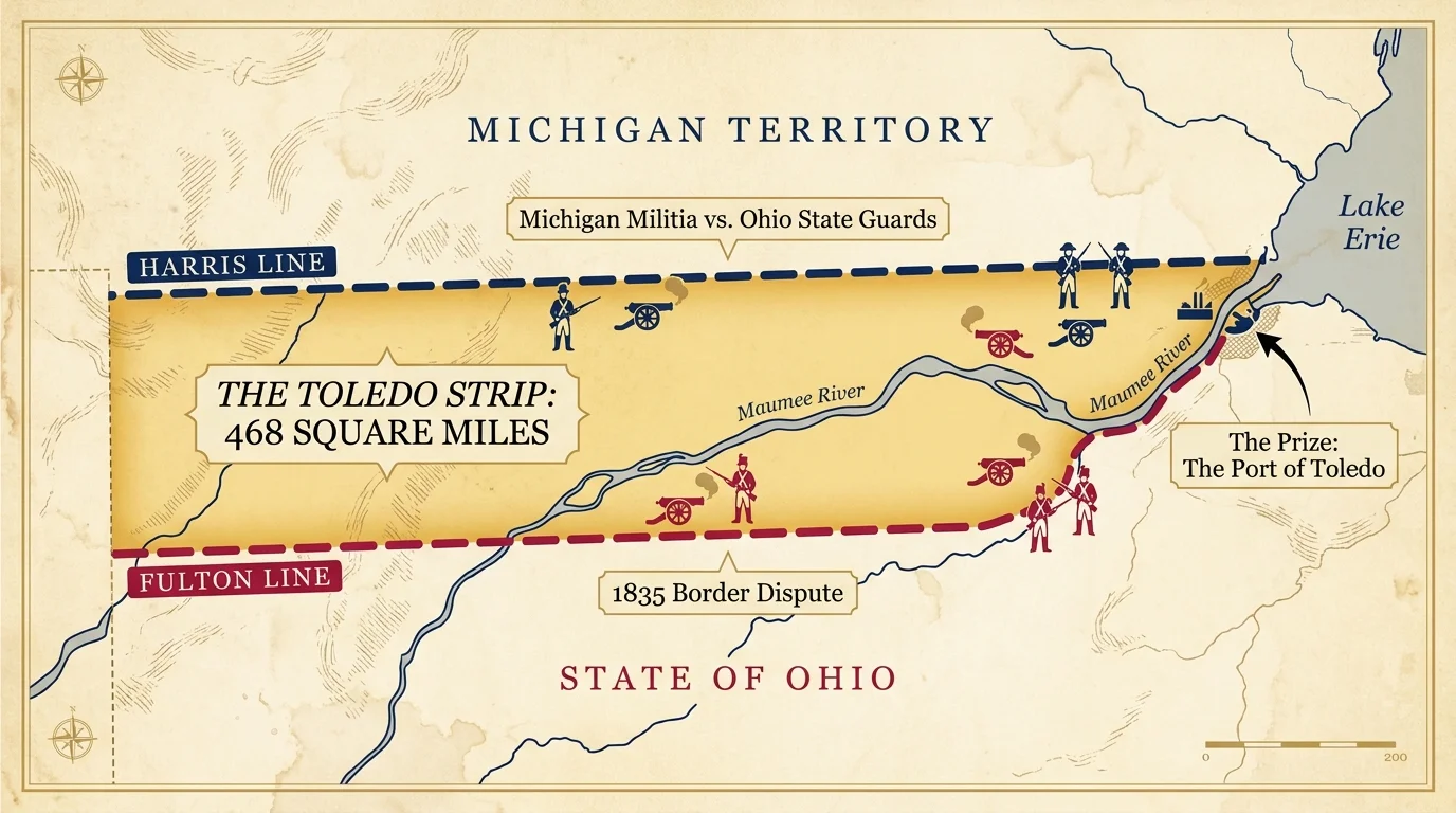
5. The Toledo War Pits State Against State
You rarely hear about states deploying military forces against one another outside the context of the Civil War. Yet, in 1835, the State of Ohio and the neighboring Michigan Territory raised armed militias to fight over a 468-square-mile strip of land known as the Toledo Strip. Due to wildly inaccurate maps drafted during the Northwest Ordinance of 1787, both governments legally claimed the territory, which included the economically vital port city of Toledo at the mouth of the Maumee River.
Michigan’s aggressive young leader, Governor Stevens T. Mason, mobilized his territorial militia and passed the Pains and Penalties Act, criminalizing any Ohio official who attempted to exercise jurisdiction in the strip. Ohio’s Governor Robert Lucas responded by marching his own state militia to the border. For months, the two armed camps stared each other down, engaging in espionage, capturing enemy surveyors, and shouting insults across the swampy divide. In the entire conflict, the only recorded casualty occurred when a Michigan deputy sheriff suffered a minor stab wound from an Ohio partisan wielding a penknife.
President Andrew Jackson eventually intervened, desperate to prevent a regional war. Congress forced a compromise: Ohio received the Toledo Strip, and Michigan received the entire Upper Peninsula as a consolation prize—along with official statehood. At the time, Michiganders believed they had lost a valuable port for a barren wasteland, but the subsequent discovery of massive copper and iron deposits in the Upper Peninsula fueled Michigan’s industrial rise. You can learn a clear lesson here: bureaucratic mapping errors create real-world chaos, and perceived losses often disguise long-term advantages.